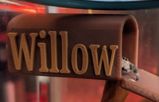
BUSTER has already jumped all over it, while I watched. Suzanne did all the haulage getting it here; Keith apparently bailed in a haze of ditziness after an offer to assist. It’s fucking enormous and awkward af. I helped her get it up the stairs. It’s now blocking an interior doorway because tipping it over is only just barely a one person job.
Going to see Jarmo and Susanna and Mike on Friday at a sushi joint close by.
Already 525 words into TB today and the section is FINALLY OVER and the journey can begin IN A DIFFERENT CAR. they’re currently driving into the sunrise in my mind, I now have to establish when in April they’re driving so I can establish the time of sunrise…. and the weather at the time. For all I fucking know it could have been snowing.
All of BC is on fire or at risk. The interior is closed to traffic except firefighters and support staff going in and climate refugees coming out. Twitter had half a dozen ‘before and after shots’ of people’s homes lost to the Shuswap fire (Adams Complex Fires) and of course the BC fire service is now having to explain how a controlled burn saved hundreds of homes but destroyed the hamlet of Sqwilix. Locals say the communication and coordination was sorely lacking and they got chased out of their homes without the order – they were already on alert. The West Kelowna Fire (McDougall Creek) shows 50 houses lost, and 5 more in Kelowna proper as of 12 hours ago.
Uncle Steve (whose titled land I was on last year) and Dax are supposed to be driving up there, I have no idea how they’ll accomplish the drive with the road closures. Apparently the RCMP are being right dicks about turning people back for some reason.
This is the road advisory for this instant… these links will almost immediately die so ignore them unless you’re looking today.
This page provides additional information during significant events impacting travel on BC highways. As always, DriveBC remains your best option for current road information.
- A Provincial State of Emergency was declared on August 19, 2023 due to wildfire activity across the province.
- The province has issued an order restricting travel to wildfire-affected communities in the southern interior of the province.
- The order is designed to discourage and stop recreational and leisure travel for tourist accommodation. The order does not restrict essential travel through or to these communities – including for work, for school and to help care for a sick loved one.
- For more information visit EmergencyInfoBC
Okanagan – Shuswap
August 20, 2023
- Highway 1 remains CLOSED between Chase and Blind Bay intersection (east of Sorrento) due to active wildfire. Assessments are underway and crews are on site responding.
- Holding Bridge on Holding Road is CLOSED
- Squilax-Anglemont Road is CLOSED from its intersection with Highway 1
- Highway 5A is open with a travel advisory in effect
- Highway 97 remains open in West Kelowna and Kelowna
- Westside Rd is CLOSED from Highway 97 to Fintry
Your primary sources of current highway and emergency information are:
Fraser Canyon
August 21, 2023
- Highway 1 between Boston Bar and Lytton is CLOSED due to active wildfire (Kookipi)
- A checkpoint is in place at Ross Road in Haig (just west of Hope)
- Full closures are in place at Canyon Alpine (6 km north of Boston Bar) and at the Highway 1/12 Junction in Lytton
- BC Hydro repair work is underway
- Danger tree and rockfall assessment in progress
Your primary sources of current highway and emergency information are:
Highway 4 – Cameron Bluffs
August 18, 2023
In addition to the regular daily closures, there will be a full day-time closure to allow crews to remove approximately a dozen refrigerator-sized boulders as part of the rock-scaling work being done at Angel Rock, which has proved to be the most challenging segment of the bluff.
Weather permitting, this closure will take place:
-
- Thursday, Aug. 24, 2023 8:30 a.m. until 9 p.m
The Cameron Bluffs Fire event area remains single lane alternating with non-scheduled pilot cars.
For further information See the Cameron Bluffs Recovery page, including about the detour route
Your primary sources of current highway and emergency information are:
- Highway condition and event information: DriveBC.
- Emergency alerts and evacuation information: EmergencyInfoBC